Abstract: The Tactical Stalemate at Sharpsburg
A narrow tactical frame
The September 17, 1862 engagement along Antietam Creek lasted roughly 12 hours and drew the Army of the Potomac and the Army of Northern Virginia into a three-mile active combat front. That scale can tempt a reader toward grand political conclusions, but the Sunken Road rewards a narrower lens. Here, terrain explains behavior.
The focus here is the tactical problem at Sharpsburg: natural depressions, road cuts, bridge approaches, and bluffs shaped what infantry could see, where officers could move men, and how quickly casualties accumulated. The Sunken Road did not become lethal because it resembled a modern trench. It became lethal because its shallow grade, local approaches, and compressed fields of fire turned ordinary infantry formations into targets at intimate range.
The two sectors treated here are the Confederate center at the Sunken Road and the Union left flank at Burnside's Bridge. They differed in geometry but not in principle. In both places, the ground narrowed choices faster than commanders could correct them.
Main Point: At Antietam, tactical stalemate came less from indecision alone than from the way terrain converted movement into exposure.
Methodology: Spatial and Archival Analysis
How the ground was read
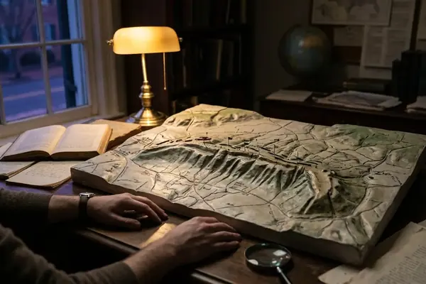
I began with a simple test: place 1862 mapping over modern imagery and examine the resulting alignments. That approach failed quickly. Post-1890 agricultural terracing altered enough micro-topography to make a direct overlay look cleaner than the historical ground deserves.
The stronger method compared roadbed depression, line of sight, and period photographic evidence against wartime accounts. The Sunken Road's depression varied between two and four feet below surrounding grade, a modest measurement on paper but a decisive one for a standing infantryman trying to fire or advance under smoke. According to measurements preserved in topographical studies and field observation, that shallow cut could hide torsos, distort range judgment, and mask the full strength of a defending line until attackers reached dangerous proximity.
Primary source integration required care. Casualty reports showed where formations suffered, officer leave-taking documents helped identify leadership disruptions, and post-battle photography taken within a roughly 48- to 72-hour window supplied evidence of the road's visual character. The photographs cannot stand alone. Burial details had already begun moving bodies and altering the immediate soil composition before the camera lenses were focused, so the images clarify terrain but do not freeze the battlefield at the instant of combat.
Reconciling opposing accounts
Union and Confederate reports often describe the same ground from incompatible angles. The criteria used here favor accounts that align with physical terrain, casualty timing, and command responsibility. A dramatic recollection written decades later carries less weight than a terse report whose stated position matches a known field of fire.
Caution: Discrepancies between official after-action reports and photographic evidence of terrain alteration should not be treated as clerical mistakes. They often reveal the pressure officers felt to explain confusion, loss, or delay.
Key Findings: Topographical Geometry of the Sunken Road
The road as defensive instrument
Brig. Gen. Daniel Harvey Hill used the Sunken Road as a natural defensive trench, but the position did not grant automatic security. Its strength depended on disciplined fire control and a willingness to absorb pressure before answering it. The road protected men from some direct observation; it did not protect them from being fixed in place.
Col. J. B. Gordon's deployment of the 6th Alabama shows the logic clearly. Gordon held fire until Union infantry closed to close range, as commonly cited at fewer than 30 yards, then released a maximized single volley from smoothbore muskets. At that range, the technical limitations of the weapons mattered less than the density of the target and the shock of surprise.
Reconstructing Gordon's line of sight from the Roulette Farm approach reveals why the first Union assaults under Maj. Gen. Edwin V. Sumner struggled to read the position. Advancing men saw fence lines, smoke, and fragmented silhouettes before they understood the roadbed's full shape. The grade drop from the approach into the road created a visual delay. By the time many attackers recognized the defensive alignment, they had entered the zone where command gestures, shouted orders, and unit cohesion started to break apart.
Failure of frontal assaults against entrenched smoothbore musketry at ranges measured near 50 yards or less
The lesson is not that frontal assault always failed. Civil War infantry sometimes carried strong positions by mass, timing, and luck. At the Sunken Road, however, the geometry favored a defender who could remain concealed until the final moments of approach. Sumner's initial attacks struck a line that had turned a farm lane into a firing shelf.
That distinction matters. The road did not function as a fortress. It functioned as a temporary amplifier of defensive fire.
Key Findings: The Mechanics of Enfilade Fire and Flanking
When the geometry reversed
The same road that helped Confederate defenders resist frontal pressure exposed them once Union troops worked onto the flank. A linear depression protects best against force coming from the front. It becomes dangerous when fire travels lengthwise down the position.
The 14th Connecticut played a notable role in this transition. Its movement helped create longitudinal enfilade fire, striking along the Confederate line rather than against it. Contemporary language described the effect as a death-dealing crossfire, and the phrase fits the mechanics: men who had crouched behind the road's lip now faced fire from angles the original deployment had not been built to absorb.
The collapse of the Confederate center came between 12:45 PM and 1:15 PM. Tracing that window requires cross-referencing Lt. Col. J. N. Lightfoot's post-battle testimony with casualty timelines from the adjacent 5th North Carolina. Lightfoot's mistaken withdrawal orders did not create the crisis from nothing. They gave administrative form to a tactical condition already deteriorating under flank pressure.
Command language under fire
Orders in a roadbed full of smoke, wounded men, and splintered formations rarely move with textbook precision. A single misunderstood instruction can travel faster than a corrective order. Around the Sunken Road, that problem carried fatal consequences because the line had no elastic depth behind it. Once men began leaving, neighboring units had to interpret whether they were witnessing an authorized withdrawal, a local adjustment, or a collapse.
Field observation: On a staff ride, stand in the roadbed first, then step out toward the Union approach. The change in visibility is more instructive than any map symbol.
Key Findings: Terrain Bottlenecks at Burnside's Bridge
The bridge approach as a tactical funnel
Burnside's Bridge presented a different problem: not concealment inside a road, but compression at a crossing. Maj. Gen. Ambrose Burnside's operations on the Union left flank began recorded around 10:00 AM, yet the terrain gave Confederate defenders time that their numbers alone should not have provided. The approach forced attacking units toward a narrow stone bridge under observation from higher ground.
Confederate rifle-pits and artillery positions on the bluffs shaped the fight. Enfilade artillery fire, including grape and canister where conditions allowed, made standard infantry rushes costly. A commander could order speed, but the bridge dictated frontage.
Contrast the options. A direct rush promised concentration but offered the defenders a predictable target. A wider movement sought maneuver but consumed time on broken ground and risked separation from the main effort. Burnside's difficulty lay in choosing between bad clocks: the clock of casualties at the bridge and the clock of operational delay.
A.P. Hill and the closing window
Maj. Gen. A.P. Hill's movement from Harpers Ferry tightened that window. His troops made a forced march commonly cited at 17 miles, with approximately seven hours of continuous marching, and their arrival sequence reinforced a Confederate flank that had been nearing failure. Reports tied to the movement around 6:30 AM underscore how early decisions outside the bridge sector shaped the late-day fight there.
Robert E. Lee, Confederate General commanding the Army of Northern Virginia, benefited from terrain that bought time until marching men could matter. That does not absolve Confederate risk. It shows how battlefield geography could transform delay into survival.
Key Findings: Medical Logistics and Battlefield Realities
Casualties after the firing stopped
The tactical story did not end when the lines shifted. The volume of musketry and artillery casualties overwhelmed field care across the Antietam landscape. Field hospitals absorbed men torn by close-range fire, shell fragments, grape, and canister, while surgeons worked with the materials they could reach rather than the supplies they wanted.
The Poffenberger farm notes are especially valuable because they move the record away from official quartermaster language and into the practical world of improvised care. Surgical operations continued through the night of September 17. Lanterns extended the workday, not the surgeons' strength. Corn husks served as dressings when conventional supplies ran short.
Clara Barton's supply lines mattered because they changed the timing of relief. Supply wagons reaching the northern sector gave surgeons and attendants a better chance to stabilize the wounded after the first wave of shock. This is not a claim that supplies solved the medical catastrophe. They altered survival prospects in a system already stretched beyond normal capacity.
Why logistics belongs in tactical analysis
Medical evidence helps locate the intensity of combat. Where surgeons clustered, where wagons arrived, and where night operations continued, the battlefield reveals the afterimage of fire. Tactical visibility and medical burden belong in the same discussion because one produced the other.
Scope and Limitations of the Tactical Record
Where the evidence breaks
The Antietam record contains durable gaps. Permanent gaps in after-action reports for the 2nd North Carolina limit reconstruction of the afternoon phase. The loss of regimental commanders, including officers such as Colonel Tew, stripped later investigators of the people best positioned to explain local decisions.
The fog of war also complicates the timeline of Gen. George B. McClellan's orders. Several late-nineteenth-century memoirs adjust dispatch times in ways that appear designed to protect reputations. Those accounts should not be discarded because they are late, but they must answer to earlier correspondence, staff patterns, and the physical possibility of movement across the field.
What can still be said responsibly
We can reconstruct patterns more securely than minute-by-minute certainty. The Confederate center collapsed within a bounded window. Union exploitation lagged. The left flank fight consumed time against terrain that favored defense. Those conclusions rest on converging evidence, even where exact language from commanders remains incomplete.
The best tactical history keeps two truths in view: soldiers experienced the field as confusion, and historians must still make disciplined judgments from fragmentary evidence.
Conclusion: Strategic Impact and Command Failures
Terrain bought time, but not victory
Lee's Army of Northern Virginia used terrain to offset numerical disadvantage for a critical span of the day. The Sunken Road delayed and punished Union attacks until flanking fire reversed its value. Burnside's Bridge slowed the Union left long enough for Confederate reinforcement to matter. In both sectors, terrain did not replace command; it shaped the range of possible command decisions.
McClellan's failure to commit roughly 20,000 fresh troops held in reserve remains central to the strategic critique. After the breakthrough at the Sunken Road, the Army of the Potomac possessed an opportunity that the Confederate center could not easily repair. Caution, fragmented command control, and the sheer violence of the field combined to prevent decisive exploitation.
The result was tactical survival for Lee but strategic failure for the Maryland Campaign. The Army of Northern Virginia withdrew across the Potomac on September 18-19. Antietam therefore stands as a battle where ground, timing, and command hesitation intersected with national consequence, even when this analysis keeps its focus on the battlefield itself.
Main Point: The Sunken Road was not merely a place of slaughter. It was a terrain problem that first protected a line, then trapped it.