The ground at Gettysburg did not favor whoever held it by default. It rewarded whoever read it correctly. On the rocky elevations that bracketed the Union line on July 2, 1863, two officers solved the same problem—how to anchor a flank against superior numbers, and arrived at radically different solutions because the terrain beneath them demanded it.
This analysis treats Little Round Top and Culp's Hill not as parallel heroics but as a single tactical lesson told twice. The defenders who succeeded understood that a flank is only as strong as the topography it rests upon, and that the surface under your feet dictates whether you build earthworks or simply bend your line and pray.
The Flank Crisis of July 1863
By the evening of July 1, the Army of the Potomac and the Army of Northern Virginia were converging piecemeal onto the same few square miles of Pennsylvania farmland. The fighting north and west of town had already collapsed the Union First and Eleventh Corps, and the survivors fell back onto the high ground south of Gettysburg. What looked like a defeat was, in topographical terms, an accidental gift.
Union engineers reading the ground along Cemetery Ridge recognized what the contour lines offered. Anchoring the flanks on the rocky elevations of Culp's Hill and Little Round Top would force the Army of Northern Virginia to attack uphill, across broken ground, against a line that could not easily be turned.
The price of arrival was paid in exhaustion. Elements of the Army of the Potomac covered between 30 and 35 miles in the 24 hours before the engagement, and troops arrived in fragments between late evening on July 1 and dawn on July 2. The defensive position was sound; the men holding it had marched themselves to the edge of collapse to reach it.
The Challenge: Ewell's Discretion and the Day 1 Toll
Lee's order to Ewell on the evening of July 1 carried a fateful qualifier: take Cemetery Hill, if practicable. The discretion has fueled a century and a half of argument.
Ewell evaluated what stood in front of him—troops who had fought hard through the afternoon, no immediate artillery support, and a Union position already stiffening on the heights. He declined the assault. Whether that judgment cost the Confederacy the campaign remains the great unanswerable question of the second day's defense, because by the morning of July 2 the high ground was no longer practicable for anyone.
The human arithmetic of July 1 explains the urgency. The 24th Michigan Volunteer Infantry entered the day's fighting with 496 effectives. The morning roll call on July 2 recorded 99 men present for duty. A regiment had been reduced to the strength of a large company in a single afternoon.
The violence did not respect the conventions of combatants and non-combatants. Chaplain Horatio S. Howell of the 90th Pennsylvania Infantry was killed on the steps of Christ Lutheran Church—then serving as a field hospital, at roughly 4:30 PM on July 1. The chaotic urban fighting that swept through the town left such deaths as evidence of how completely the battle had overrun the ordinary categories of war.
The Solution (Left Flank): Chamberlain's Sickle-Shape Defense
On the extreme left, the 20th Maine held the literal end of the Union army. Beyond Joshua Lawrence Chamberlain's line there was nothing—no reserve, no anchor, only the wooded southern slope and the certainty that a successful flanking move there would roll up the entire position.
The 15th and 47th Alabama, commanded by Col. William C. Oates, found that gap and tried to exploit it. As Confederate lines began overlapping his own, Chamberlain made the decision that defines the engagement. He ordered the left wing of the 20th Maine to step back and form a right angle to the main line, creating the 'sickle' formation that presented a continuous front to an enemy trying to curl around it.
The fight that followed was a contest of endurance. The 20th Maine expended their standard issue of 60 rounds per man over roughly 90 minutes of sustained combat. Oates' Alabamians pressed five distinct assaults against the Union left, each absorbed by a line bending but not breaking under shot, shell, and canister.
When the cartridge boxes ran empty, Chamberlain had no ammunition left to absorb a sixth assault. The bayonet charge that swept down the slope was not a stroke of inspired aggression so much as the only remaining option—a desperate conversion of an exhausted defense into a downhill shock that broke the Confederate momentum.
The collapse of Sickles' salient at the Peach Orchard, fought out on the same afternoon, offered the counter-lesson. By advancing his Third Corps beyond the established topographical anchors, Sickles created a vulnerable salient that Longstreet's assault crushed. The contrast is instructive: Chamberlain held because he stayed tethered to his ground; Sickles broke because he abandoned his.
The Solution (Right Flank & Center): Earthworks and Enfilading Fire
The right flank tells the story differently, because the ground gave the defenders something Little Round Top could not—soil deep enough to dig.
Brig. Gen. George S. Greene first considered a standard linear defense along the upper slope of Culp's Hill. He abandoned it. The terrain was vulnerable to enfilade, and a thin line strung along the crest would have been raked from the flank. Instead, Greene's brigade spent roughly six hours on the morning of July 2 constructing breastworks, building defensive works that averaged three to four feet in height and incorporated the existing rocky outcroppings into a crescent-shaped arrangement of lunettes.
This is the central variable that separates the two flanks. The effectiveness of breastworks depended on what lay beneath them. Culp's Hill allowed substantial timber-reinforced earthworks because the soil ran deep, whereas the solid diabase of Little Round Top restricted defenders to shallow rock walls. Same army, same day, two entirely different defensive vocabularies—dictated by geology.
When the Confederate assaults came against the right, defense in depth and enfilading fire neutralized them. Attackers funneled by the terrain into killing zones found themselves taking fire not only from the front but along the length of their advance. The crescent works converted the hill's contours into a trap.
The center-left fighting at the Rose Farm rounds out the picture. There Joseph Kershaw's South Carolinians engaged Union forces across open farmland that offered none of the protections of either flank—a reminder that the army's survival on July 2 depended on the strong points at its ends holding firm while the middle absorbed enormous punishment.
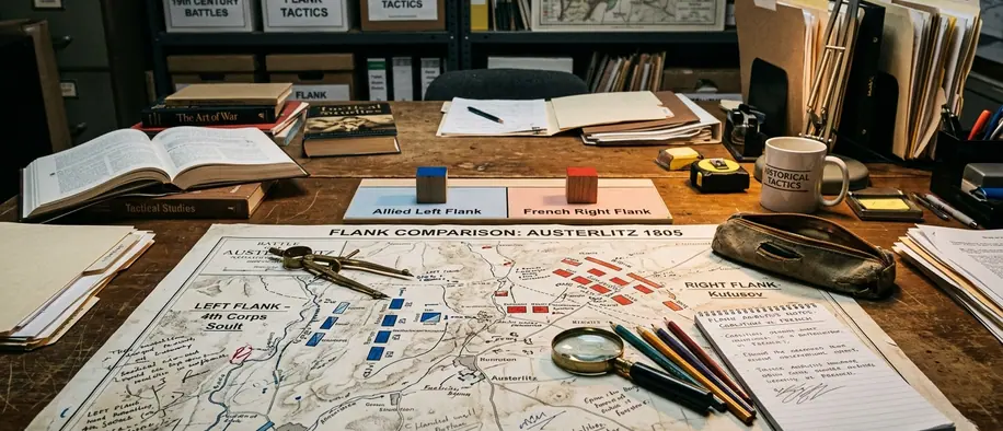
Tactical Comparison of the Two Flanks
Tactical Comparison: Left vs. Right Flank Defenses (July 2, 1863)| Flank Sector | Topographical Features | Primary Defensive Tactic | Key Defensive Unit | Preparation Time |
|---|---|---|---|---|
| Extreme Left (Little Round Top) | Exposed diabase boulders, steep western face | Refused line in sickle formation, bayonet counter-charge | 20th Maine | Minimal—improvised under fire |
| Right & Center (Culp's Hill) | Deep soil, wooded slope, rocky outcroppings | Crescent breastworks, defense in depth, enfilading fire | Greene's brigade | Roughly six hours |
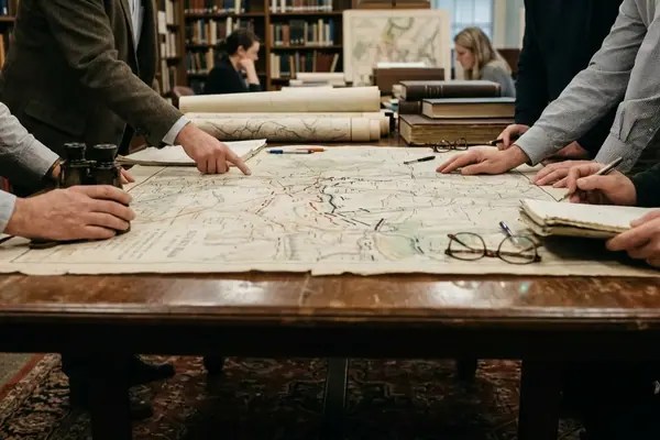
Evaluating Primary Sources: The Oates and Chamberlain Accounts
Reconstructing what happened on Little Round Top requires confronting an uncomfortable fact: much of what we believe comes from men describing their finest hour decades after they lived it.
Oates published his detailed account in the Southern Historical Society Papers on April 6, 1878—nearly 15 years after the battle. Chamberlain's narrative did not settle into a single version either; his telling evolved over a 40-year period on the post-war lecture circuit, shaped by audiences, hindsight, and the slow alchemy that turns survived terror into coherent narrative.
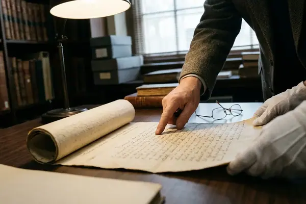
Modern researchers cross-reference these post-war memoirs against the Official Records, prioritizing the immediate after-action reports filed within weeks of the battle. Those contemporaneous documents filter out the embellishments that accreted around the famous moments. When a memoir and an 1863 report disagree, the report generally wins.
Yet the method has a cost worth naming. Relying strictly on immediate after-action reports excludes critical tactical context that officers only grasped years later, when they walked the ground again—sometimes alongside their former adversaries, and finally understood what they had been doing in the smoke. Oates and Chamberlain corresponded after the war, and their reflective accounts, for all their drift, preserve insights that no breathless 1863 dispatch could contain. The careful historian reads both registers and trusts neither absolutely.
Results & Legacy: Restoring the 1863 Battlefield Condition
The Union flank defenses succeeded. The army held the high ground on July 2, and that achievement set the conditions for the campaign's decision on July 3. The tactical lesson—anchor to terrain, adapt your method to the ground, was vindicated at both ends of the line.
The legacy work today is a different kind of defense: defending the visual evidence of what happened. Over the intervening century and a half, non-historic tree growth gradually erased the sightlines that made the 1863 tactics legible. A summit that once commanded a clear field of fire became a wooded hilltop where visitors could no longer see why the position mattered.
Park historians and forestry teams have addressed this by consulting 1863 Brady and O'Sullivan photographs to identify which trees post-date the battle. They then clear specific tracts to restore the artillery sightlines. Recent rehabilitation on the western slopes of Little Round Top involved removing non-historic vegetation across a 4-acre parcel, re-establishing the 1863 visual connection between the summit, Devil's Den, and the Wheatfield. Stand on the cleared slope now and the tactical logic reassembles itself in front of you.
This restoration proceeds through long-running collaboration—the National Park Service working with the Civil War Preservation Trust and the National Trust for Historic Preservation to cull trees and recover historical sightlines. The work is deliberately incremental, balancing ecological concerns against fidelity to the 1863 landscape, and it remains ongoing. For the documented history of the ground itself, the National Park Service maintains the authoritative record.
The defenders of July 2 read the ground and shaped their tactics to it. The preservationists of today read the same ground in reverse, stripping away the accumulated decades to let the terrain speak its tactical lesson once more.